Plan Next Season's Chesapeake Cruise
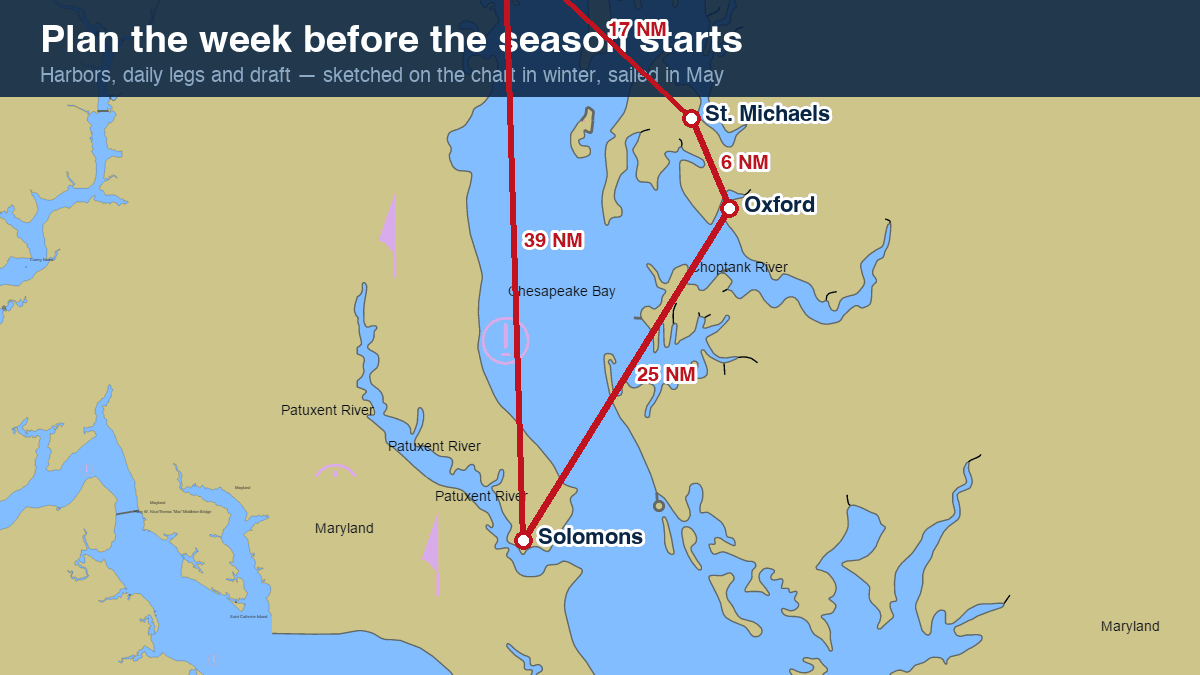
The best May cruises are drawn in January. The Bay rewards planning: 150 miles long, twenty rivers, and more good harbors than any season can hold. Here's a winter planning method that produces a float plan you'll actually follow.
Start with distances, not dates
Comfortable Bay cruising runs 25–40 NM a day for sailboats, 40–60 for trawlers. Every harbor page lists straight-line distances to its neighbors — chain them into legs and the itinerary writes itself. Classic first week: Annapolis → Rock Hall → Chestertown → St. Michaels → Oxford → Solomons and home.
Plan around your draft
Set your boat profile once on the chart (draft, air draft, safety margin) and the route tool refuses water that doesn't fit — including bridge clearances and, with the Tide option on, the tide predicted at the passage. Deep-draft boats should read each harbor's Local knowledge section: controlling depths at Kent Narrows or Tangier decide routes more than mileage does.
Weather windows and currents
Spring northwesters make the open Bay rough for a day or two at a time — plan a flex day per week. Time narrows and canals for slack with the current predictions, and ride the fair current on the long legs: a knot of help for six hours is a free six miles.
Try a ready-made route
These links open the chart with a route already drawn — auto-routed around the shoals for the boat profile they carry:
- Annapolis → St. Michaels, 22 NM — around Bloody Point and Tilghman Point into the Miles
- Rock Hall → Annapolis, 13.5 NM — the classic cross-Bay hop
- Kent Narrows transit, shoal draft — a 2.5 ft-draft boat threading the 5 ft cut
Save the routes now
Build each leg on the interactive chart with auto-routing on, export GPX for your plotter, and keep the share-links in your float plan. When the water warms, the thinking's already done.
Keep learning
- How Deep Is the Chesapeake Bay? Average 21 ft, 174 ft at Its Deepest
- Chesapeake Bay Water Temperature — Live Readings and Monthly Averages
- How Long Is the Chesapeake Bay? Size, Width and Crossing Times
- Is the Chesapeake Bay Salt Water? The Salinity Gradient, Explained
- Are There Sharks in the Chesapeake Bay? What Actually Swims Here
- Winterizing Your Boat on the Chesapeake
- How to Read a Nautical Chart
- When Is High Tide? Chesapeake Bay Tides and Currents, Explained
- Depth, Draft and Safety Margins on the Bay
- Planning a Chesapeake Bay Cruise