Is the Chesapeake Bay Salt Water? The Salinity Gradient, Explained
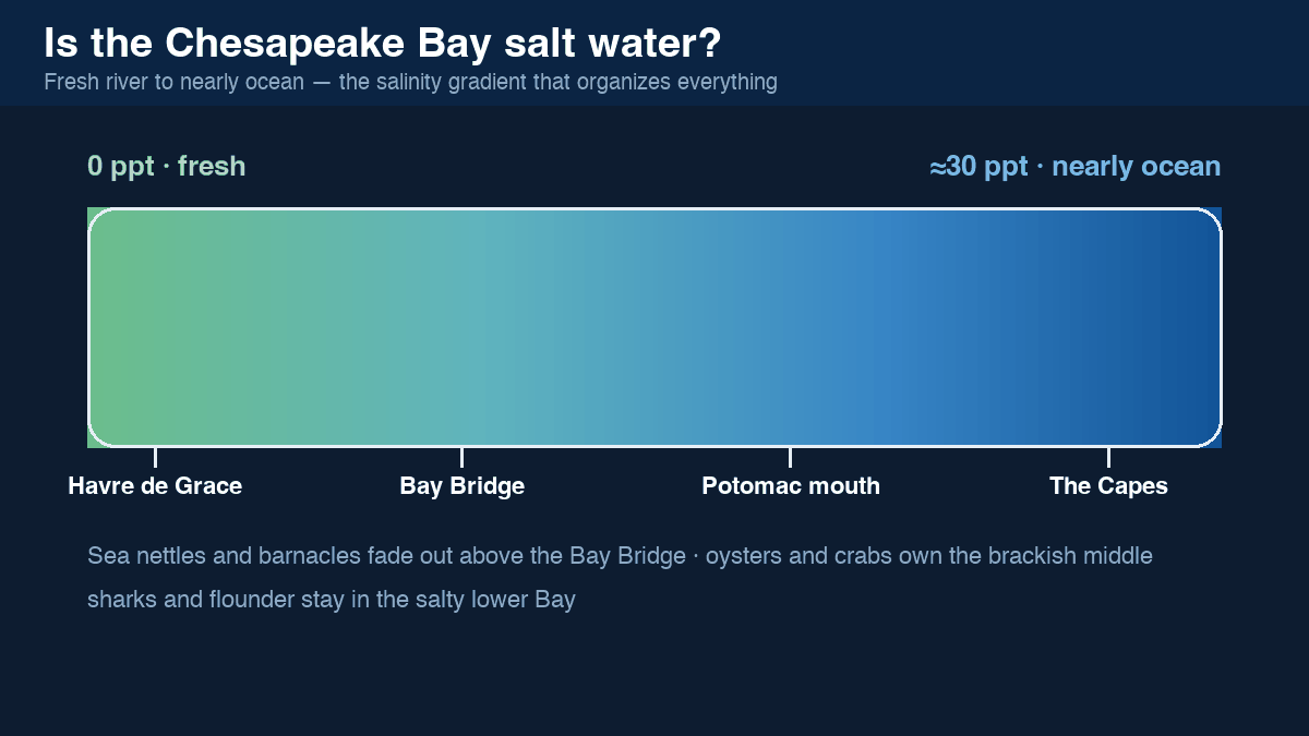
Both — and neither. The Chesapeake Bay is an estuary, where river water meets the sea, so its salinity runs on a smooth gradient: essentially fresh (0 parts per thousand) at the Susquehanna mouth, to nearly full ocean strength (around 30 ppt) at the Virginia capes — the ocean itself is about 35 ppt. The middle Bay, from Annapolis to the Potomac, is classic brackish water around 10–20 ppt.
Where the zones fall
- Fresh to barely brackish (0–0.5 ppt): the Susquehanna Flats and river heads — Havre de Grace, upper Sassafras, Chestertown
- Lightly brackish (0.5–5 ppt): the upper Bay to about the Bay Bridge in a wet spring
- Moderately brackish (5–18 ppt): the heart of the Bay — oyster and blue-crab country
- Salty (18–30 ppt): Tangier Sound south to Hampton Roads and the capes
The whole gradient slides seasonally: snowmelt and spring rain push the salt line down the Bay; drought summers pull ocean water far up it.
What it means in practice
- Boats: the nearly fresh upper rivers mean little barnacle fouling and gentler corrosion — one reason the upper Bay is prized for wintering and hull storage
- Swimmers: stinging sea nettles need salt — they rule the middle Bay in July–August but can’t reach the fresh upper rivers
- Anglers: the gradient is the fish map — largemouth bass in the fresh reaches, stripers everywhere, flounder and spot toward the salt
Related: live water temperatures and how deep the Bay is.
Keep learning
- How Deep Is the Chesapeake Bay? Average 21 ft, 174 ft at Its Deepest
- Chesapeake Bay Water Temperature — Live Readings and Monthly Averages
- How Long Is the Chesapeake Bay? Size, Width and Crossing Times
- Are There Sharks in the Chesapeake Bay? What Actually Swims Here
- Winterizing Your Boat on the Chesapeake
- Plan Next Season's Chesapeake Cruise
- How to Read a Nautical Chart
- When Is High Tide? Chesapeake Bay Tides and Currents, Explained
- Depth, Draft and Safety Margins on the Bay
- Planning a Chesapeake Bay Cruise