Solomons Island Nautical Chart
One of the Bay's best natural harbors, tucked inside the mouth of the Patuxent River behind Drum Point. The chart covers the deep-water approach (30+ ft in the river), the marked entrance into Back Creek and Mill Creek, and the anchorages off Molly's Leg. An easy all-weather entrance makes Solomons the classic mid-Bay stopover.
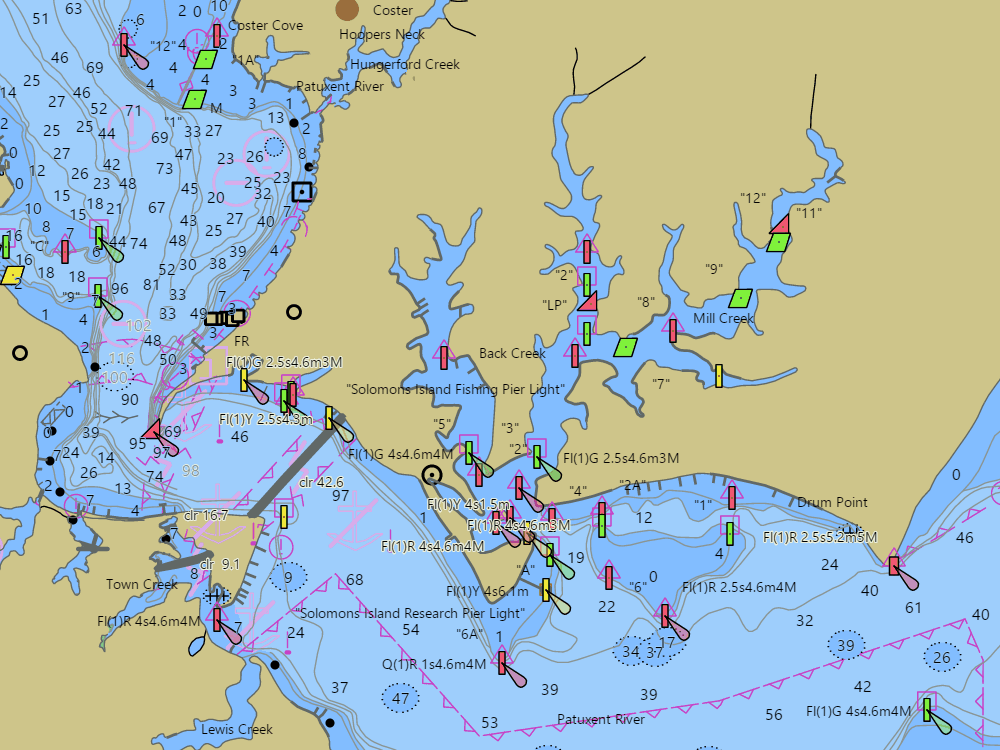
NOAA ENC chart sample, depths in feet at MLLW — tap the chart to explore live. For planning only, not for navigation.
Open the interactive Solomons Island chart →Free, no signup — works on your phone and installs like an app.
Next tides — Solomons Island
Loading today’s tides…
Full predictions: Solomons Island tide chart.
Local knowledge
- All-weather entrance behind Drum Point; the Patuxent carries 30+ ft to the river mouth
- Back Creek and Mill Creek marked channels roughly 8–12 ft, verify locally
- Gov. Thomas Johnson Bridge upriver: 140 ft charted clearance
On the chart
- Official NOAA ENC data with soundings in feet at MLLW — see how to read a chart
- Buoys, lights, hazards and restricted areas — tap any mark for details
- NOAA tide & current stations with live predictions
- GPS position, route planning and boat-profile depth warnings
Nearby harbors
Straight-line distances for rough passage planning — use the route tool for real courses and times.
- Point Lookout & the Potomac Mouth — about 19 NM
- Cambridge — about 23 NM
- Oxford — about 25 NM
- Smith Island — about 28 NM
- St. Michaels — about 29 NM
- All harbor charts →